
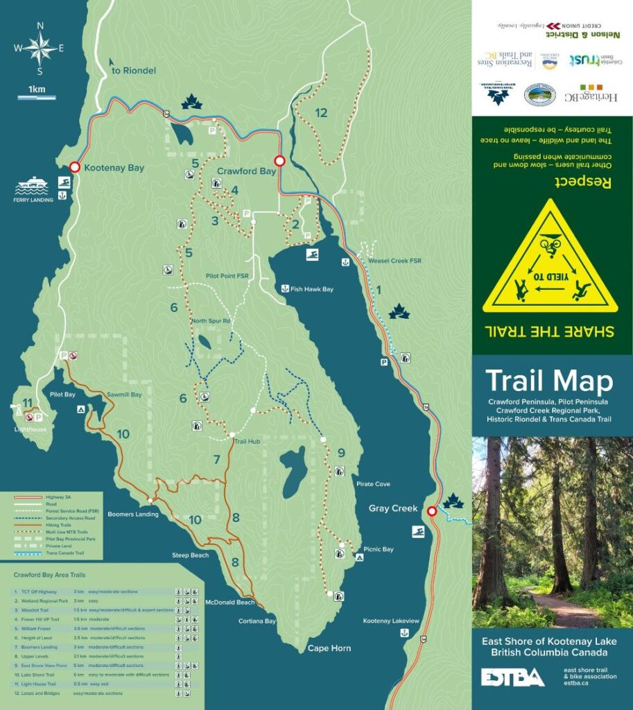
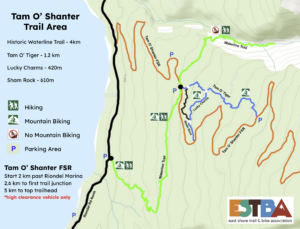
Tam O’ Shanter Trail Area
Tam O’Shanter Trail Area on Trailforks.com Hikers are welcome to explore the area keeping in mind its primary use designation. This trail does not
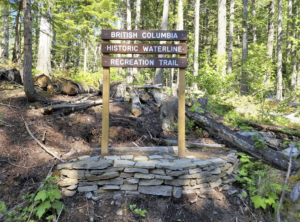
Waterline Riondel Trail
Trailforks link Riondel Historic Waterline Trail In 1905, the Bluebell lead/silver mine had been resurrected by the Canadian Metal Company. In order to develop
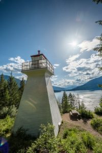
Pilot Bay Lighthouse
Constructed in 1904, and activated in 1905, the Pilot Bay Lighthouse is the last remaining inland lighthouse in British Columbia and is a white,

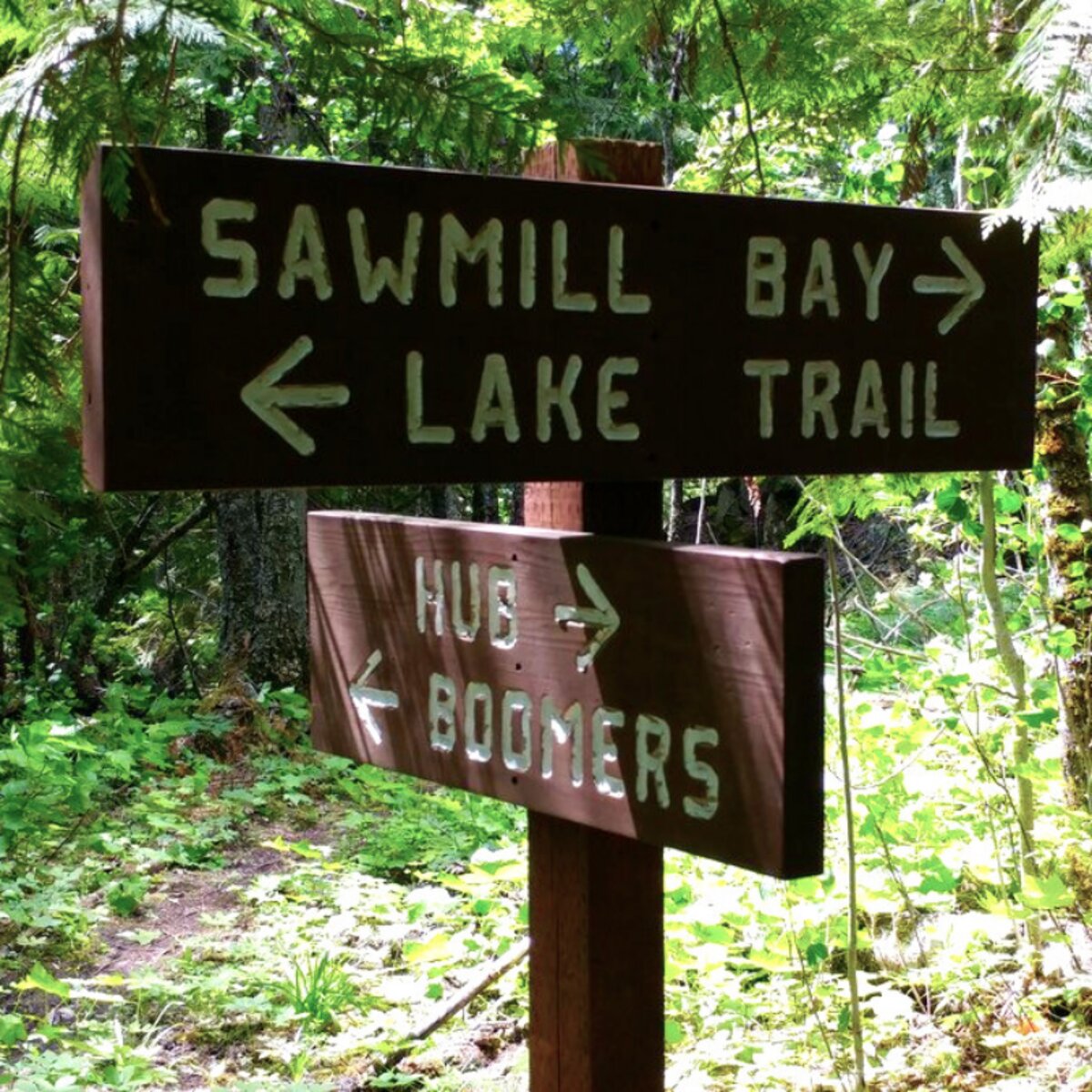
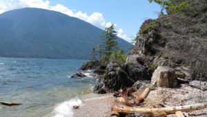
Pilot Bay Provincial Park Lakeshore and Boomer’s Landing Trail
Primary Role The primary role of Pilot Bay Provincial Park is to provide visitors and the local community with marine destination recreational opportunities, with upland

Crawford Creek Regional Park Wetland Trails
Trailforks link Crawford Creek Regional Park / Wetlands Trail From Peters Road/ Highway 3a corner, travel 350 meters to the beginning of the trail at

Trans Canada Trail
Trailforks link Trans Canada Trail The East Shore segment of the Trans Canada Trail begins in Kootenay Bay. The traveler, after enjoying the free

Woodlot Trail
Trailforks link Woodlot Trail (original route) This hiking/biking trail can be accessed from the bottom at the second corner of Peter’s Rd in Crawford

Fraser Hill Viewpoint
Trailforks link Fraser Hill Viewpoint Trail The network of multi-use trails on the northern part of the Crawford Peninsula offers quick access to some beautiful

William Fraser Trail
Trailforks links William Fraser north 1 William Fraser north 2 William Fraser south At one time the historic William Fraser Trail was

Height of Land Trail
Trailforks links: Height of Land Trail south Height of Land Trail north This super fun mountain bike / hiking trail is a classic 4 km
Boomer’s Landing Trail
Trailforks link: Pilot Bay Provincial Park and Boomers Landing The Boomers Landing Trail can be accessed from the top Trail Hub 3.5 km up Pilot

Upper Levels and Steep Beach Trails
Trailforks link Upper Levels and Steep Beach Trails Follow the Boomers Landing trail down to the park junction. Rather than descending into the park continue
East Shore Viewpoint Trail (and Picnic Bay Rec Site access)
Trailforks link Upper Levels and Steep Beach Trails The entrance for the East Shore Trail trailhead is located 3km up Pilot Point FSR (1/2
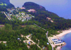
Riondel Heritage Trail
This non-motorized trail offers users a unique introspective into the historic community of Riondel. The route connects segments of new forest trails with parks, alleys
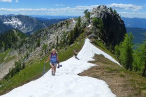
Mt Crawford/Plaid Lake
Photo credit Lorna Robin Mt Crawford/Plaid Lake Access: The trailhead is accessible via 12.6 km of logging roads, which require high-clearance vehicles and 4WD for the
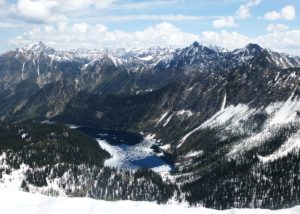
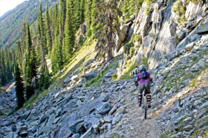
Sphinx Mountain Hike
Photo credit Lorna Robin Sphinx Mountain Hike – contributed by Lorna Robin Sphinx Mountain is a prominent double peak southeast of Crawford Bay, looking rather

Mount Loki
Mt. Loki Access: Easy. Portman Road is a good 2WD road with minimal water bars; however, watch out for large rocks if you do not
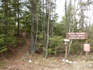
Pebble Beach
Rating: Easy to moderate. Short but somewhat steep, with some rough sections. Access: Easy. Drive: Follow Eastman Ave. through the small town of Riondel, and
Lockhart Creek Trail
The Lockhart Creek Provincial Park Trail follows the north side of Lockhart Creek gaining about 800 metres of elevation over a three-hour hike. An old

Haystack Mountain
Submitted by Lorna Robin Access: Sanca Creek Road, 17.6 km gravel road from Hwy 3A to trailhead. A 2WD vehicle could be okay with careful